Witnessing Hurricane Helene: September 2024
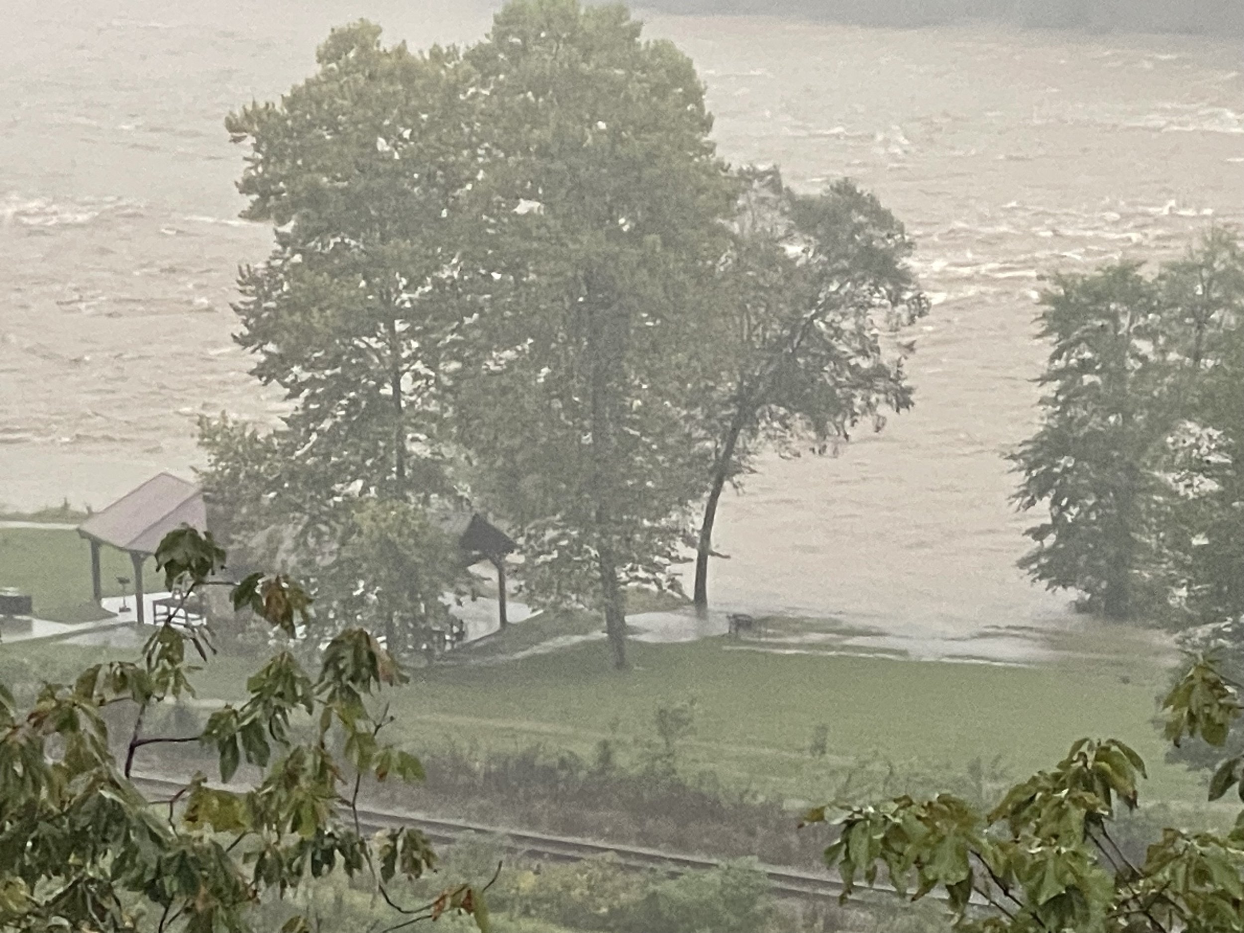
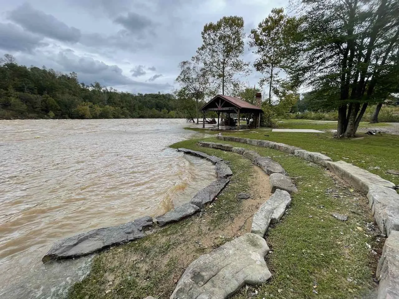
The flooding started in my section of the French Broad River (Olivette neighborhood in Woodfin just north of Asheville) on Thursday morning with a different storm system that flooded some roads on Wednesday evening. I had never seen the water breach the shore, so I took this picture to alert the neighborhood. September 26, 8:12am
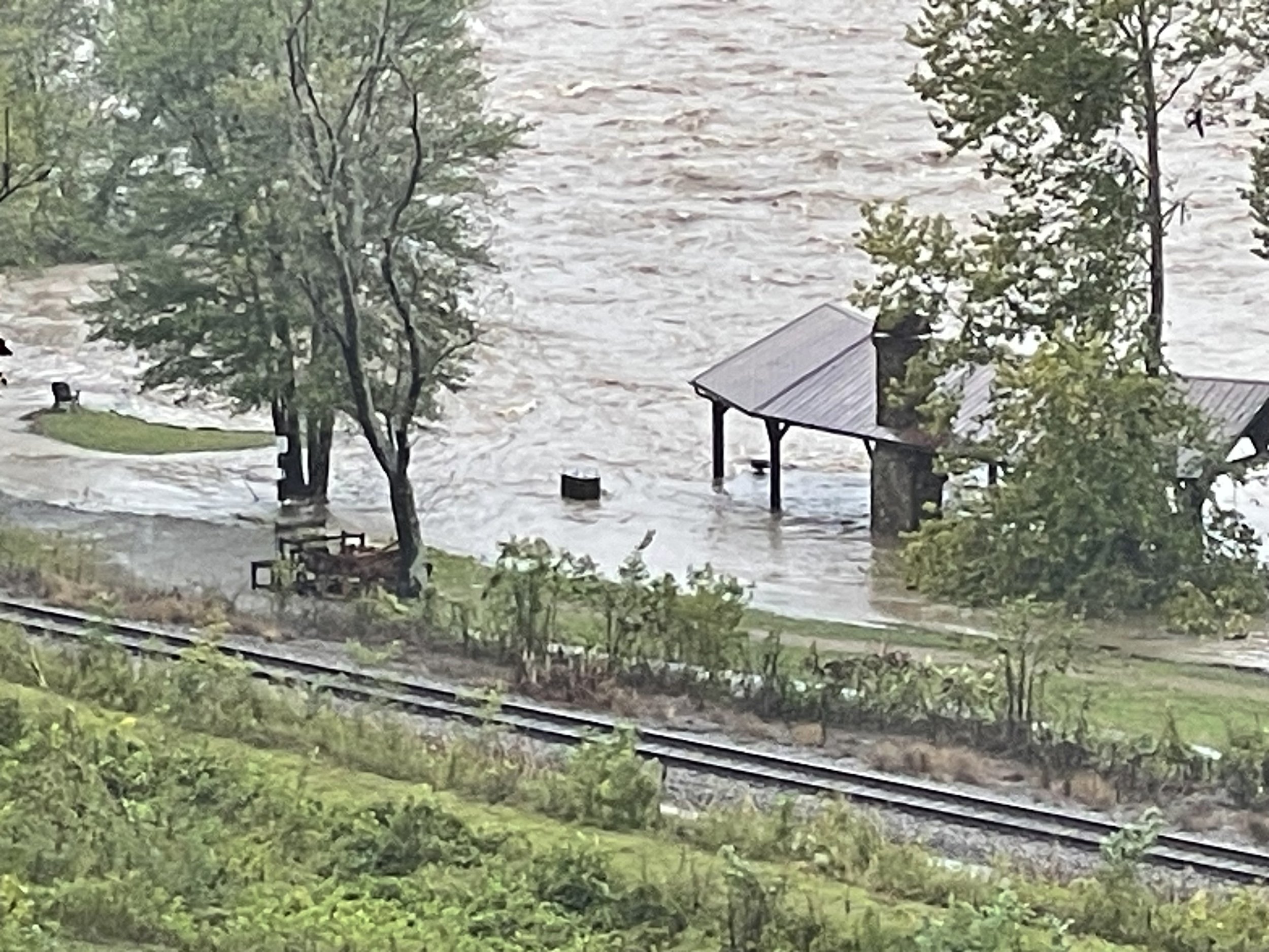
The hurricane had not arrived in our region, but I was already seeing flooding I had never seen before from rains that began late afternoon on Wednesday, September 25. In this picture taken only 30 minutes later than the one above (Thursday, September 26 at 8:38am) the water had risen even more. (Note the bench overlooking the river is now almost surrounded by water.)
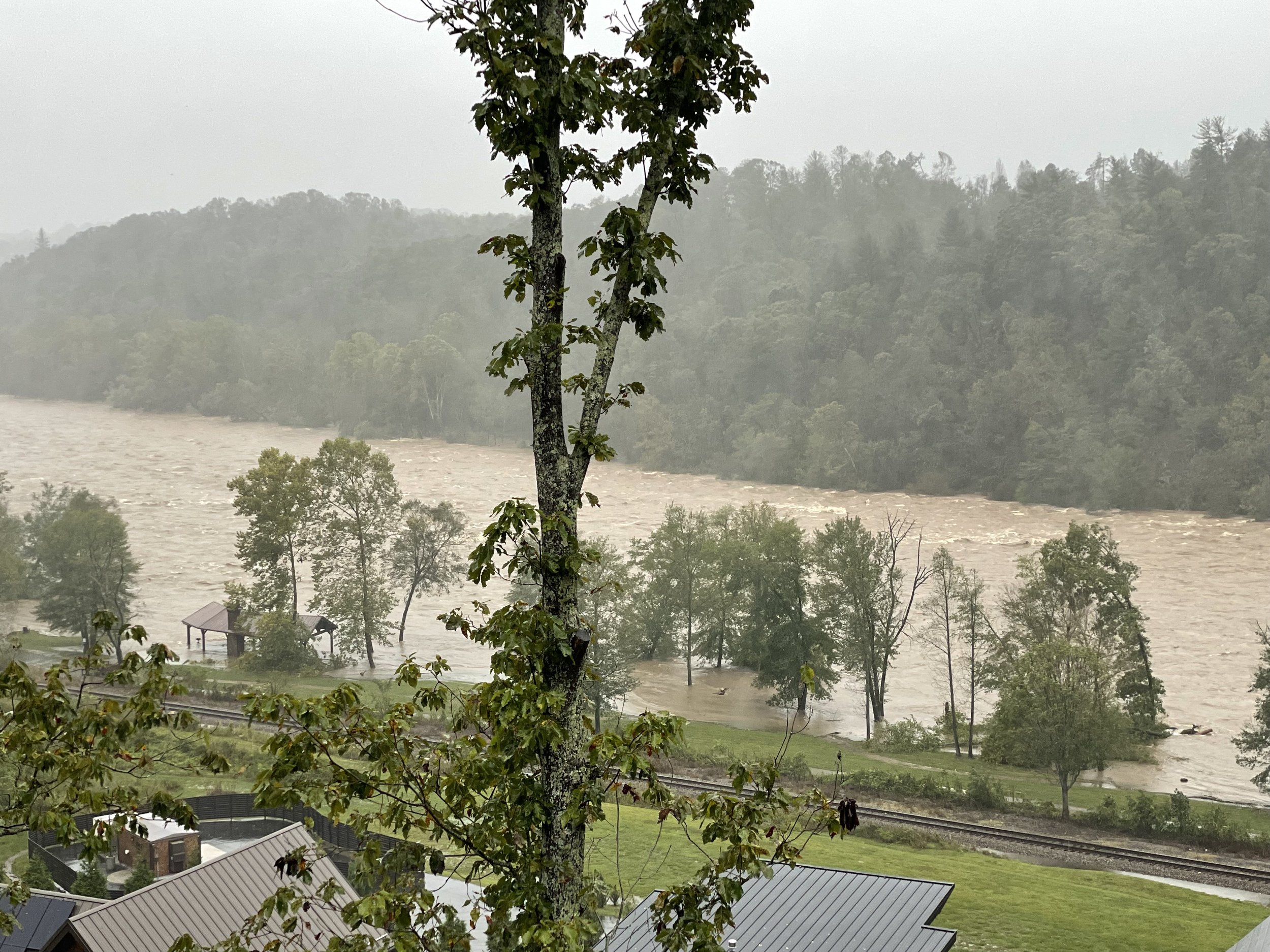
Friday morning around 6am cell service and power went out. Neighbors had also mentioned on Wednesday that water pressure was low, so, although we all still had water we were starting to wonder for how long. Friday, Sep 27 at 9:53am.
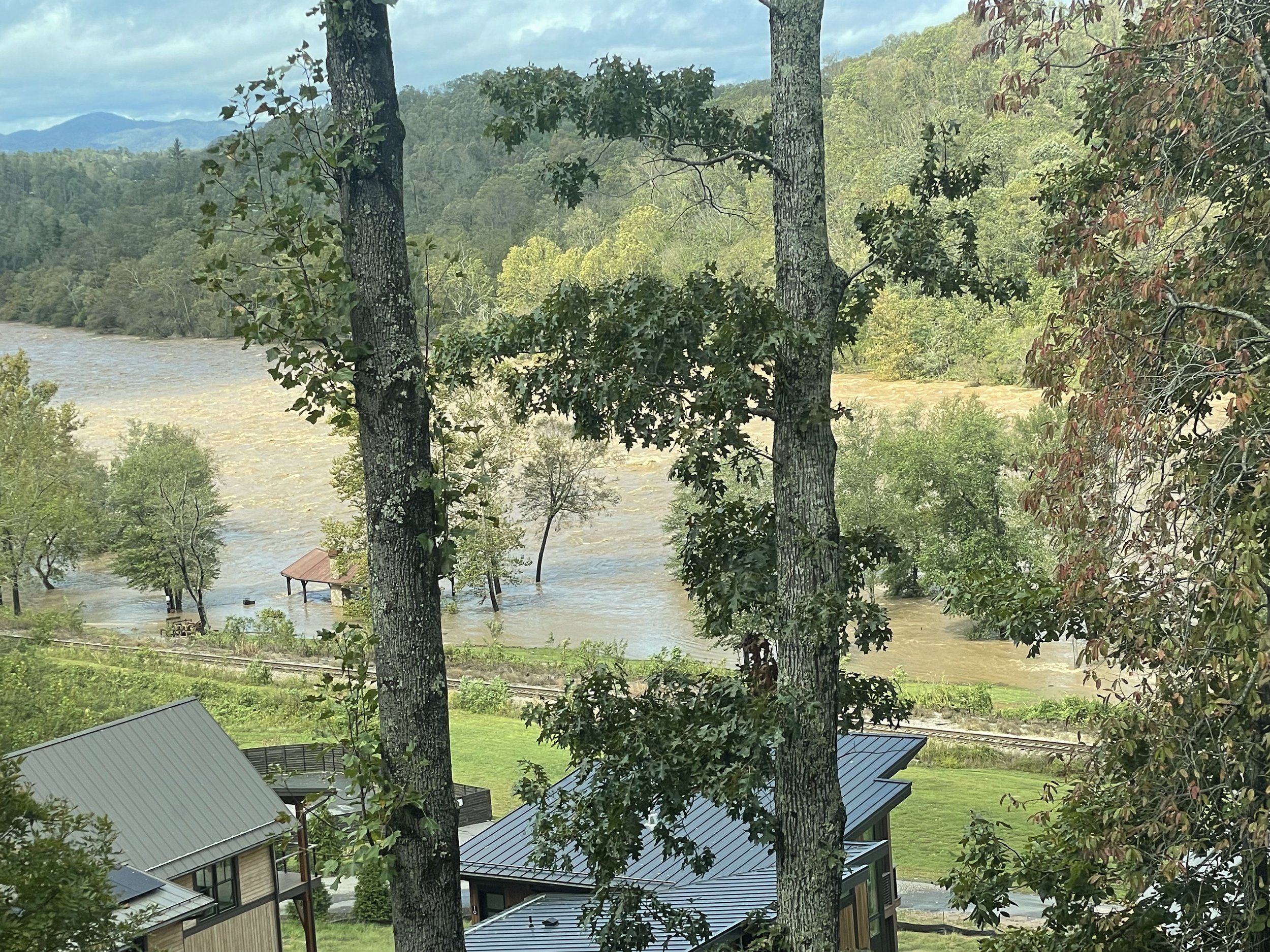
The headwaters of the French Broad are located in Rosman, southwest of Asheville--in areas that (from glimpses of forecasts on Thursday when we still had internet and cell service) were forecast to get around 10 inches of rain with the hurricane. The river then meanders northeast (with countless runoffs, creeks and rivers flowing into it) past the Asheville airport, through the Biltmore property to Asheville where the Swannanoa River joins it (the Swannanoa River flows from the Black Mountain area west through Swannanoa, East Asheville, Biltmore Village and on into the Frenc Broad). The joined rivers then run straight through the River Arts district in Asheville. Pic: Friday, September 27, 9:54am.
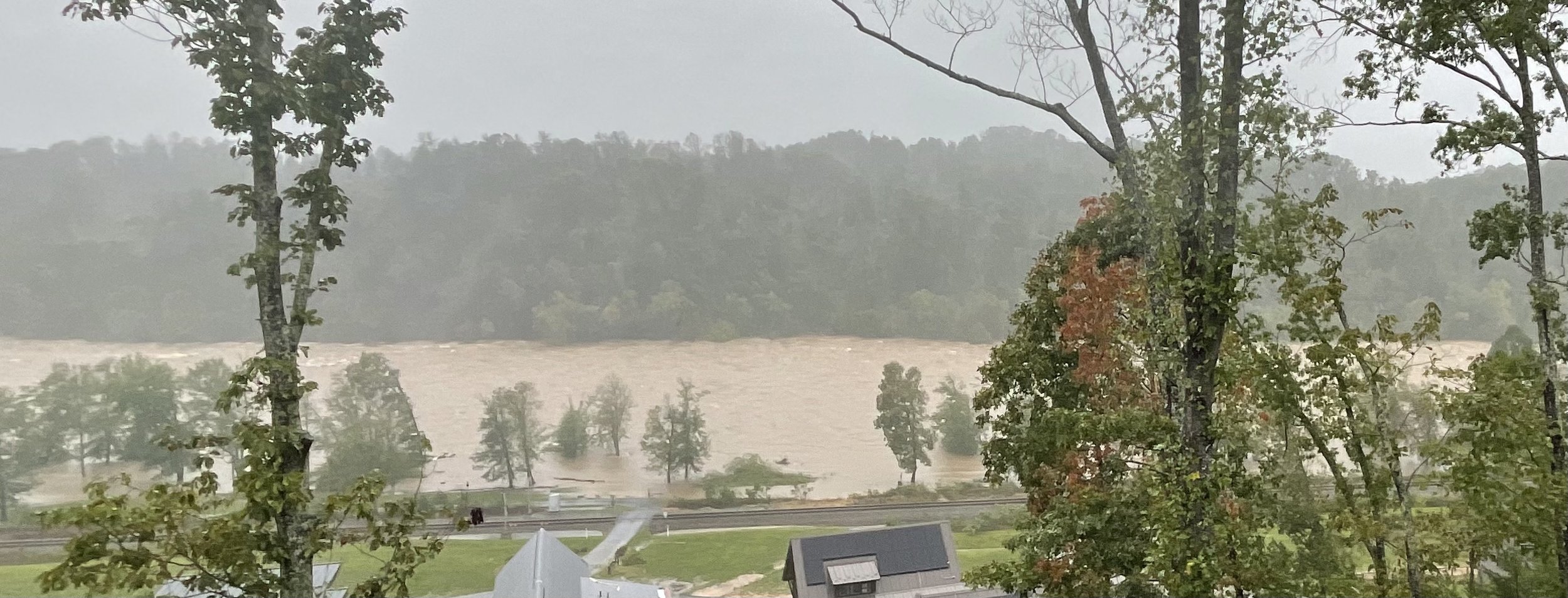
The French Broad is very wide in my neighborhood. There is a park on the edge of the river and a raised railroad bed (15 feet or so??) and then another large field that is kind of a wetland and protects the houses below mine. Many homes and businesses in western NC, however, are located near narrow creeks and rivers with often only one road in and out. Pic: Friday, September 27, 9:52am.
Small, meandering creeks are especially dangerous. Even a small amount of water running down a hill is incredibly powerful. And in these little creeks, the water can rise higher than you think is even possible because the water has nowhere to go (and it sweeps everything in its way along with it). There are creeks like this all over western NC. Most eventually find their way to a river. This is Lees Creek in my neighborhood that feeds into the French Broad. Fortunately, no homes or structures are located near the creek. Picture Friday, Sep 27, 9:52am.
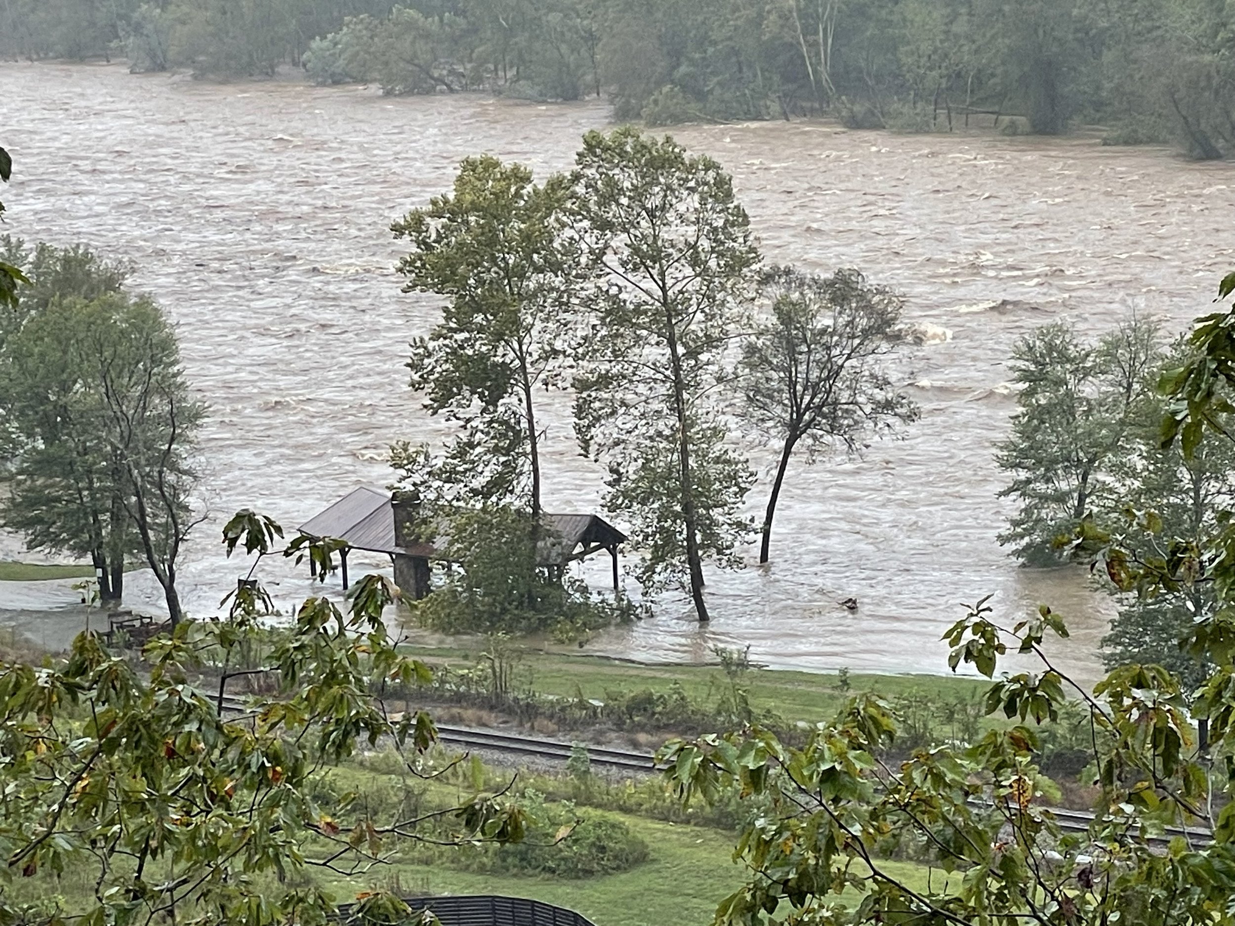
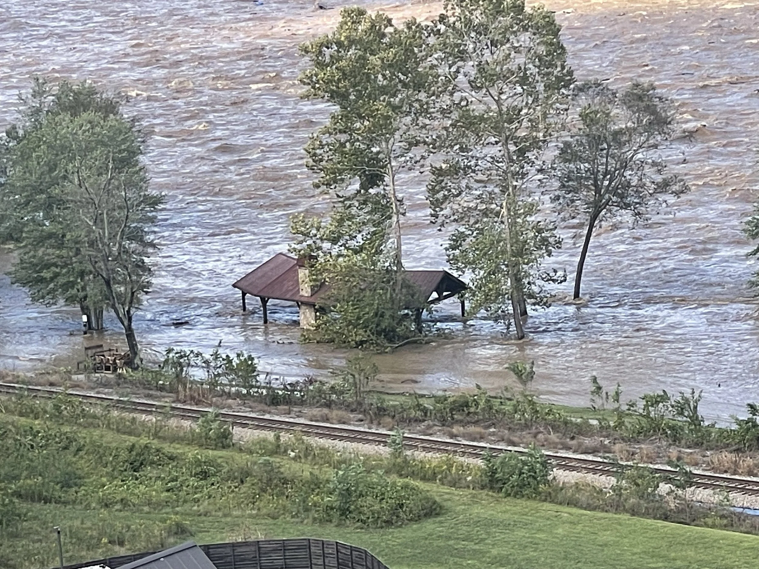
The "Pavilion" is the only structure in the park below my house. The water has now completely surrounded it. (The hurricane by this point has passed through Asheville.) Picture: Friday 10:32am
The French Broad River (south of us) runs north right through Asheville's River Arts district (with a greenway and many businesses and restaurants). (The River Arts district is the area seen on most broadcasts about the flood in Asheville.) After passing through Asheville, the river then continues north into Woodfin where it narrows and runs along Riverside drive where many businesses and homes are located including an enormous pipe manufacturing plant (Silver-Line Plastics). I do not know anything about how the businesses and homes along Riverside Drive have fared (or if Riverside Drive is even there). All I know is I began to see masses of pipes begin to wash downstream. (Note the large black pipe in the picture.) The debris from Silver-Line Plastics would have needed to go over the Craggy Dam Reservoir. Picture: Friday 11:38am.
The roar and speed of the water--even at this very wide portion of the river--was frightening. And all that water and everything it was headed north to friends and family in Marshall, Hot Springs and on into Tennessee. Video: Friday, September 27, 11:49am (around two hours after the eye passed through).
The water kept rising--and was starting to near the stack of picnic tables and benches my neighbors had tried to move to "safety". The black square in the water in the foreground is trash cans anchored to the ground. Picture: Friday, September 27, 11:55am
Most of the riverfront park area at this point was submerged. Picture: Friday, September 27, 1:11pm
And the water kept rising. (Notice the trash cans are almost completely submerged by this point.) Pictures: Friday 2:14pm
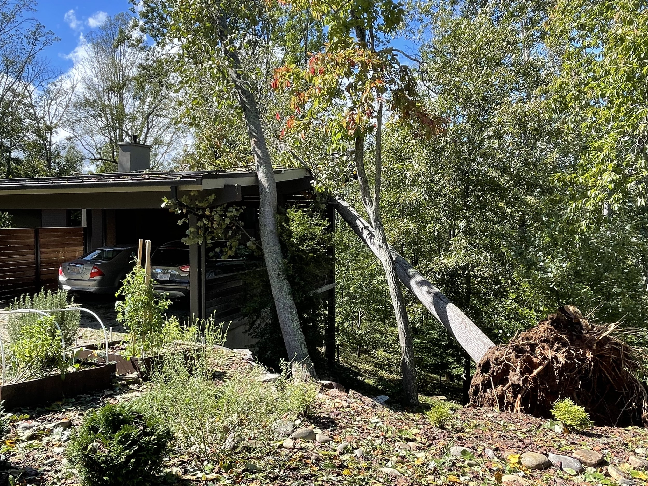
It wasn't until Friday afternoon when I finally got out and talked to neighbors that I realized the eye of the storm had gone right over us. One huge tree fell on my neighbors' drive (missing their house by inches), another enormous tree fell on a house just a few hundred feet up the road and another fell on a neighbor's carport (and one in my backyard that didn't damage anything). It didn't take much imagination to extrapolate that if all these trees had fallen within a quarter mile radius of my house how many trees must have fallen on houses, cars, power lines, interstates, mountainsides and trails in the area. Picture: Friday, September 27 at 11:53am.
When I walked down to the riverfront I counted 3 enormous trees that had fallen on the railroad tracks at both ends of the riverfront. And that is only what I could see of about 1/2 mile of railroad track. We won't be seeing trains come through for quite a while. Picture: Friday, September 27 at 3:13pm.
And the water kept rising on a cruelly gorgeous sunny, fall afternoon. Picture: Friday, September 27, 3:35pm
This is where Lees Creek enters the French Broad. There used to be land here on both sides of the creek with a pedestrian bridge that ran over the creek to a little park area we called "Azalea Island". Picture: Friday, September 27, 3:47pm
The water continued to near the roof of the Pavilion as it got dark Friday night (around 8pm). This was the last video I took on Friday. Video: Friday , September 27, 4:48pm.
The next morning we saw that the Pavilion was still standing (unlike so many other homes and businesses). We were also relieved to see that the water was starting to slowly recede. Picture: Saturday , Sseptember 28, 11:20am
No lives or homes or businesses were lost in my neighborhood. I share these photos as just one small glimpse of what the winds and water wrought in a relatively sheltered part of the area. As I write this post the most pressing problem for my neighbors and the whole region is the problem of drinkable water. The storm damaged numerous treatment facilities all throughout the area (including ours) as well as above and below ground pipes that distribute that water. So many roads, bridges and sections of interstate have been washed out complicating repairs to all the infrastructure (I40 E and W of Asheville and I26 N are currently impassable--the only interstate in and out is I26 south of Asheville). Cell service returned to my neighborhood yesterday and power is expected to be back on for most of our county by Friday. But meanwhile, so many people are cutoff from the aid they need (especially water) due to roads being washed out or covered by trees. I am so grateful for the thousands of emergency responders, work crews and neighbors who are working so hard to care for people, get them to safety and restore infrastructure. The emergency will last for weeks. The cleanup and rebuilding will take years. I think also of people throughout our world who are suffering in wars and other devastation much greater than this. My heart goes out to you all.
